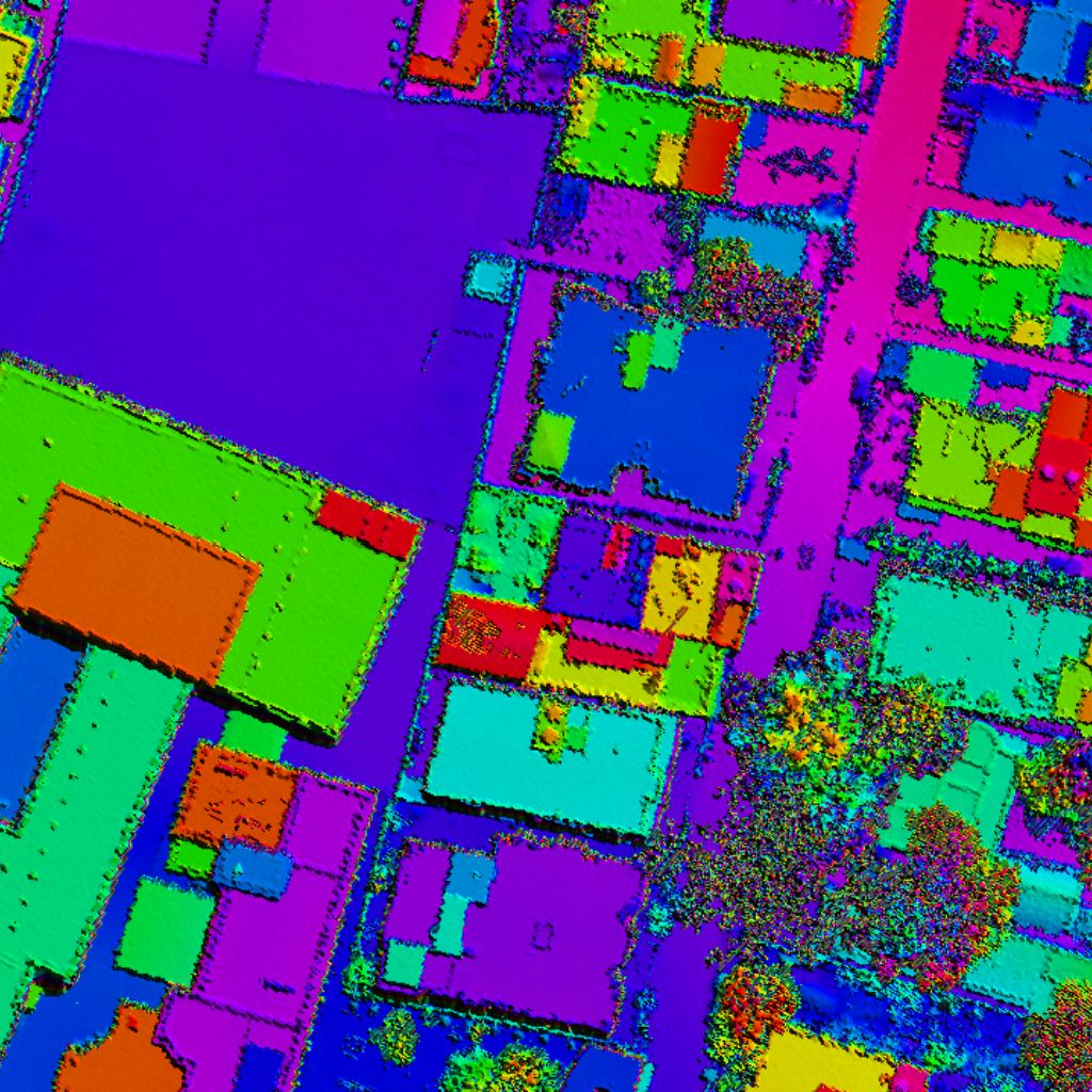
Digital Surface Models (DSMs) represent the elevation of the Earth's surface, including all natural and man-made objects such as buildings, trees, and infrastructure. DSMs provide a complete 3D view of the landscape for advanced analysis and visualization.
Includes all objects
Centimeter-level precision
Captures complex features
From cities to regions
A DSM represents the elevation of the Earth's surface by including both natural terrain and all man-made and vegetation features. It is generated from the first returns of LiDAR point clouds and is widely used for urban planning, infrastructure design, visibility analysis, flood modeling, and more.
Ground, buildings, trees
From first LiDAR returns
Captures structural shapes
High vertical accuracy
Supports many industries
Validate and organize raw LiDAR point cloud data.
Extract first returns to capture the top of all objects.
Remove outliers and erroneous points.
Interpolate points to generate DSM raster.
Ensure accuracy and consistency of DSM.
Deliver DSM in required formats and projections.
Includes all natural and man-made objects like buildings and tree canopies.
Detailed representation of complex structures, power lines and forest edges.
Centimeter-level elevation accuracy verified by rigorous calibration processes.
Scalable workflows optimized for city-wide and regional mapping grids.
Deliverables exported in GeoTIFF, LAS, LAZ, ASCII, XYZ and more.
Rapid delivery turnarounds without compromising on quality standard metrics.
3D city modeling, zoning plans, and solar potential evaluation grids.
Road alignments planning, railway checks, and utility line clearances modeling.
Water runoff gradients, inundation map simulation, and shoreline erosion checks.
Line-of-sight analysis, antenna propagation mapping, and tower placement layouts.
Canopy thickness index, biomass calculations, and habitat degradation checking.
Power pole location details, vegetation encroachment checks, and solar exposure models.
Line-of-sight coverage mapping, visibility check layouts, and tactical route checking.
Raster surface elevation grid
Interactive 3D elevation displays
Relief shaded visualization models
Vector elevation contours lines
Terrain slope gradients calculations
Slope horizontal orientation compass
Terrain profile elevation charts
GeoTIFF, ASCII Grid, LAS, LAZ, XYZ, IMG, ECW & more.
WGS84, UTM, State Plane, Local & Custom Projections.
Experienced LiDAR professionals and spatial analysts.
State-of-the-art LiDAR processing software and hardware.
Centimeter-level vertical and horizontal elevation accuracy.
From small projects to massive city-wide elevation grid projects.
Quick data deliveries without sacrificing vertical precision.
Rigorous multi-stage QC reviews ensuring reliable results.